Geolocate

Harrison Lake topographic map

Click on the map to display elevation.

About this map

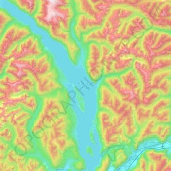
Name: Harrison Lake topographic map, elevation, terrain.

Location: Harrison Lake, Area C (Sasquatch Country), Kent, Fraser Valley Regional District, British Columbia, Canada (49.30389 -122.15335 49.75598 -121.74638)

Average elevation: 2,674 ft

Minimum elevation: 10 ft

Maximum elevation: 7,887 ft

Other topographic maps

Click on a map to view its topography, its elevation and its terrain.

Gear up for your next adventure:

🧥Waterproof Jacket for Hiking - Breathable and rugged rain jacket for outdoor excursions
📱Solar Portable Charger - Solar power bank for charging devices off‑grid
🪶Trail Camera - Capture wildlife on your hikes
🪶Camping Sleeping Pad - Comfortable sleeping pad for backpacking
👟Men's Trail Runners - Lightweight footwear for fast-paced exploration and light hiking

As an Amazon Associate, this site earns from qualifying purchases at no extra cost to you.