
Thank you for supporting this site ❤️
Make a donation
Make a donation
Gear up for your next adventure:
As an Amazon Associate, this site earns from qualifying purchases at no extra cost to you.
Majimoto topographic map
Click on the map to display elevation.
Thank you for supporting this site ❤️
Make a donation
Make a donation
Gear up for your next adventure:
As an Amazon Associate, this site earns from qualifying purchases at no extra cost to you.
About this map
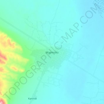
Name: Majimoto topographic map, elevation, terrain.
Location: Majimoto, Mpimbwe, Katavi Region, Western Zone, Tanzania (-7.29236 31.35625 -7.21236 31.43625)
Average elevation: 2,992 ft
Minimum elevation: 2,812 ft
Maximum elevation: 4,186 ft
Thank you for supporting this site ❤️
Make a donation
Make a donation
Gear up for your next adventure:
As an Amazon Associate, this site earns from qualifying purchases at no extra cost to you.