
Chandos Lake topographic map
Interactive map
Click on the map to display elevation.
About this map
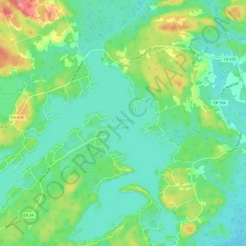
Name: Chandos Lake topographic map, elevation, terrain.
Average elevation: 1,066 ft
Minimum elevation: 988 ft
Maximum elevation: 1,253 ft
Other topographic maps
Click on a map to view its topography, its elevation and its terrain.
Anstruther Lake
Canada > Ontario > North Kawartha
Anstruther Lake, Fire Route 60b, North Kawartha, Peterborough County, Central Ontario, Ontario, Canada
Average elevation: 1,056 ft
Acton Island
Canada > Ontario > North Kawartha > Woodview
Acton Island, Fire Route 4a, Woodview, North Kawartha, Peterborough County, Central Ontario, Ontario, Canada
Average elevation: 784 ft
Griffith Island
Canada > Ontario > North Kawartha
Griffith Island, North Kawartha, Peterborough County, Ontario, Canada
Average elevation: 791 ft