Geolocate

Asinge topographic map

Click on the map to display elevation.

About this map

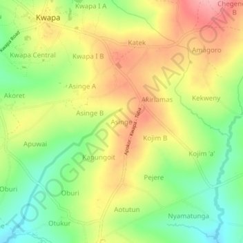
Name: Asinge topographic map, elevation, terrain.

Location: Asinge, Tororo, Eastern Region, Uganda (0.71333 34.23000 0.75333 34.27000)

Average elevation: 4,196 ft

Minimum elevation: 3,999 ft

Maximum elevation: 4,396 ft

Gear up for your next adventure:

☀️Outdoor Sunscreen - High protection sunscreen for outdoor activities
🛡️Bear Spray Outdoor - Protection in bear country hikes
📌Outdoor GPS Map App - Apps and devices for digital topographic navigation
🥾Men's Hiking Boots - Durable, waterproof footwear for rugged terrain and steep inclines
🧦Merino Wool Socks - Moisture-wicking, blister-preventing socks for long treks

As an Amazon Associate, this site earns from qualifying purchases at no extra cost to you.