Geolocate

Fiume Piave topographic map

Click on the map to display elevation.

About this map

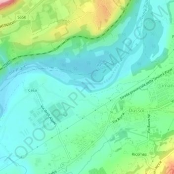
Name: Fiume Piave topographic map, elevation, terrain.

Location: Fiume Piave, Dussoi, Limana, Belluno, Veneto, 32020, Italia (46.10202 12.16784 46.10314 12.16856)

Average elevation: 1,132 ft

Minimum elevation: 981 ft

Maximum elevation: 1,598 ft

Other topographic maps

Click on a map to view its topography, its elevation and its terrain.

Giaon

Italia > Veneto > Belluno > Dussoi

Average elevation: 1,404 ft

Gear up for your next adventure:

🥘Titanium Cookware - Durable, featherlight pots and pans for backpacking
🛠️Outdoor Gear Repair Kit - Essential tools to fix gear on the trail
🧺Microfiber Travel Towels - Compact and fast-drying towels for trail use
📷Action Cameras - Rugged cameras to document your journeys across rugged terrain
🧯Emergency Survival Kit - All‑in‑one survival essentials for the backcountry

As an Amazon Associate, this site earns from qualifying purchases at no extra cost to you.