
Thank you for supporting this site ❤️
Make a donation
Make a donation
Gear up for your next adventure:
As an Amazon Associate, this site earns from qualifying purchases at no extra cost to you.
Babadağ topographic map
Click on the map to display elevation.
Thank you for supporting this site ❤️
Make a donation
Make a donation
Gear up for your next adventure:
As an Amazon Associate, this site earns from qualifying purchases at no extra cost to you.
About this map
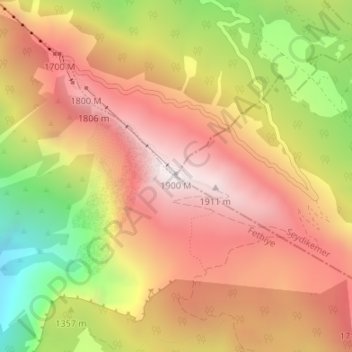
Name: Babadağ topographic map, elevation, terrain.
Location: Babadağ, Seydikemer, Muğla, Ägäisregion, Türkei (36.53028 29.18089 36.53038 29.18099)
Average elevation: 4,800 ft
Minimum elevation: 2,444 ft
Maximum elevation: 6,447 ft
Thank you for supporting this site ❤️
Make a donation
Make a donation
Gear up for your next adventure:
As an Amazon Associate, this site earns from qualifying purchases at no extra cost to you.