
Concord topographic map
Click on the map to display elevation.
About this map
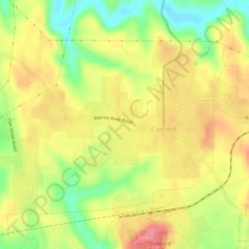
Name: Concord topographic map, elevation, terrain.
Location: Concord, Jefferson County, Alabama, United States (33.45472 -87.06071 33.48172 -87.01694)
Average elevation: 551 ft
Minimum elevation: 367 ft
Maximum elevation: 709 ft
Jefferson County trails, hiking, mountain biking, running and outdoor activities