
Thank you for supporting this site ❤️
Make a donation
Make a donation
Gear up for your next adventure:
As an Amazon Associate, this site earns from qualifying purchases at no extra cost to you.
Magunga topographic map
Click on the map to display elevation.
Thank you for supporting this site ❤️
Make a donation
Make a donation
Gear up for your next adventure:
As an Amazon Associate, this site earns from qualifying purchases at no extra cost to you.
About this map
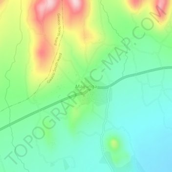
Name: Magunga topographic map, elevation, terrain.
Location: Magunga, Gwassi South ward, Suba, Homa Bay County, Kenya (-0.70783 34.13108 -0.66783 34.17108)
Average elevation: 4,439 ft
Minimum elevation: 4,121 ft
Maximum elevation: 5,092 ft
Thank you for supporting this site ❤️
Make a donation
Make a donation
Gear up for your next adventure:
As an Amazon Associate, this site earns from qualifying purchases at no extra cost to you.