
Grassersdorf topographic map
Interactive map
Click on the map to display elevation.
About this map
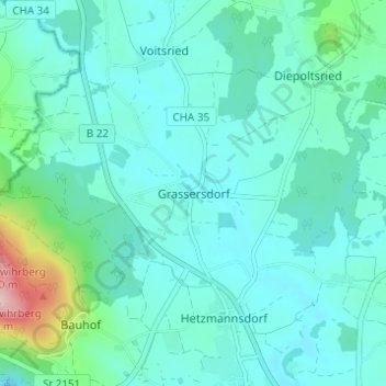
Name: Grassersdorf topographic map, elevation, terrain.
Location: Grassersdorf, Rötz, Landkreis Cham, Bayern, 92444, Deutschland (49.34543 12.50181 49.38543 12.54181)
Average elevation: 1,581 ft
Minimum elevation: 1,450 ft
Maximum elevation: 2,287 ft
Other topographic maps
Click on a map to view its topography, its elevation and its terrain.
Stanglhof
Deutschland > Bayern > Landkreis Cham > Rötz > Wenzenried
Stanglhof, Wenzenried, Rötz, Landkreis Cham, Bayern, 93488, Deutschland
Average elevation: 1,680 ft
Gruberberg
Deutschland > Bayern > Landkreis Cham > Rötz
Gruberberg, Rötz, Landkreis Cham, Bayern, 92444, Deutschland
Average elevation: 1,654 ft
Bernried
Deutschland > Bayern > Landkreis Cham > Rötz
Bernried, Rötz, Landkreis Cham, Bayern, 92444, Deutschland
Average elevation: 1,709 ft