
Thank you for supporting this site ❤️
Make a donation
Make a donation
Gear up for your next adventure:
As an Amazon Associate, this site earns from qualifying purchases at no extra cost to you.
Gruberberg topographic map
Click on the map to display elevation.
Thank you for supporting this site ❤️
Make a donation
Make a donation
Gear up for your next adventure:
As an Amazon Associate, this site earns from qualifying purchases at no extra cost to you.
About this map
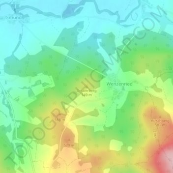
Name: Gruberberg topographic map, elevation, terrain.
Location: Gruberberg, Rötz, Landkreis Cham, Bayern, 92444, Deutschland (49.32706 12.55859 49.32716 12.55869)
Average elevation: 1,654 ft
Minimum elevation: 1,440 ft
Maximum elevation: 2,083 ft
Thank you for supporting this site ❤️
Make a donation
Make a donation
Gear up for your next adventure:
As an Amazon Associate, this site earns from qualifying purchases at no extra cost to you.