
沼山镇 topographic map
Interactive map
Click on the map to display elevation.
About this map
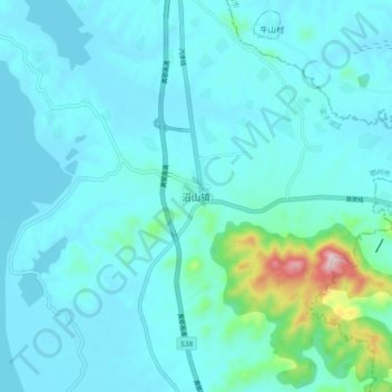
Name: 沼山镇 topographic map, elevation, terrain.
Location: 沼山镇, 鄂州市, 湖北省, 中国 (30.13193 114.62392 30.21193 114.70392)
Average elevation: 177 ft
Minimum elevation: 36 ft
Maximum elevation: 1,273 ft
Other topographic maps
Click on a map to view its topography, its elevation and its terrain.