
Thank you for supporting this site ❤️
Make a donation
Make a donation
Gear up for your next adventure:
As an Amazon Associate, this site earns from qualifying purchases at no extra cost to you.
Basibé topographic map
Click on the map to display elevation.
Thank you for supporting this site ❤️
Make a donation
Make a donation
Gear up for your next adventure:
As an Amazon Associate, this site earns from qualifying purchases at no extra cost to you.
About this map
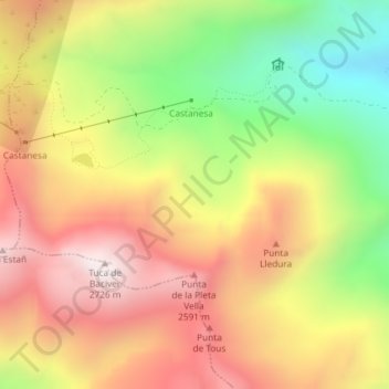
Name: Basibé topographic map, elevation, terrain.
Location: Basibé, Montanuy, La Ribagorza, Aragón, España (42.53568 0.59658 42.55568 0.61658)
Average elevation: 7,323 ft
Minimum elevation: 5,653 ft
Maximum elevation: 8,773 ft
Thank you for supporting this site ❤️
Make a donation
Make a donation
Gear up for your next adventure:
As an Amazon Associate, this site earns from qualifying purchases at no extra cost to you.