
拉德 topographic map
Interactive map
Click on the map to display elevation.
About this map
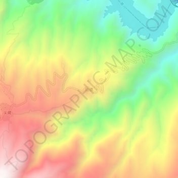
Name: 拉德 topographic map, elevation, terrain.
Location: 拉德, 尖扎县, 黄南藏族自治州, 青海省, 811200, 中国 (36.07864 101.76512 36.11864 101.80512)
Average elevation: 8,668 ft
Minimum elevation: 6,883 ft
Maximum elevation: 10,561 ft
Other topographic maps
Click on a map to view its topography, its elevation and its terrain.