
Thank you for supporting this site ❤️
Make a donation
Make a donation
Gear up for your next adventure:
As an Amazon Associate, this site earns from qualifying purchases at no extra cost to you.
chinalco topographic map
Click on the map to display elevation.
Thank you for supporting this site ❤️
Make a donation
Make a donation
Gear up for your next adventure:
As an Amazon Associate, this site earns from qualifying purchases at no extra cost to you.
About this map
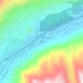
Name: chinalco topographic map, elevation, terrain.
Location: chinalco, Mahr Tunel, Yauli, Junín, Perú (-11.63370 -76.05466 -11.63267 -76.05342)
Average elevation: 13,642 ft
Minimum elevation: 13,054 ft
Maximum elevation: 14,961 ft
Thank you for supporting this site ❤️
Make a donation
Make a donation
Gear up for your next adventure:
As an Amazon Associate, this site earns from qualifying purchases at no extra cost to you.