Geolocate

Parig topographic map

Click on the map to display elevation.

About this map

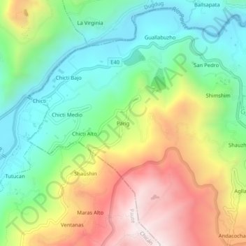
Name: Parig topographic map, elevation, terrain.

Location: Parig, Guachapala, Azuay, 010601, Ecuador (-2.79450 -78.75536 -2.75450 -78.71536)

Average elevation: 8,255 ft

Minimum elevation: 7,028 ft

Maximum elevation: 10,141 ft

Gear up for your next adventure:

☀️Outdoor Sunscreen - High protection sunscreen for outdoor activities
🎒Trail Energy Bars - High‑calorie bars for hiking energy
🥇GPS Hiking Watch - Multi‑sport GPS watch with navigation and trail tracking
🍳Camping Cook Set - Complete cookware for outdoor meals
🩳Quick‑Dry Hiking Shorts - Comfortable and quick‑dry shorts for summer hiking

As an Amazon Associate, this site earns from qualifying purchases at no extra cost to you.