Geolocate

Henrietta topographic map

Click on the map to display elevation.

About this map

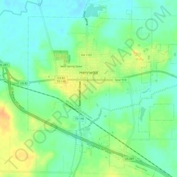
Name: Henrietta topographic map, elevation, terrain.

Location: Henrietta, Clay County, Texas, United States (33.78991 -98.21340 33.83520 -98.16523)

Average elevation: 892 ft

Minimum elevation: 846 ft

Maximum elevation: 965 ft

Clay County trails, hiking, mountain biking, running and outdoor activities

Other topographic maps

Click on a map to view its topography, its elevation and its terrain.

Charlie

United States > Texas > Clay County > Charlie

Average elevation: 951 ft

Henrietta

United States > Texas > Clay County > Henrietta > Henrietta

Average elevation: 892 ft

Gear up for your next adventure:

🎒Hydration Pack - Hands‑free water reservoir for long hikes
🛡️Bear Spray Outdoor - Protection in bear country hikes
🧦Hiking Socks - Comfortable socks to prevent blisters on long hikes
📦Dry Bags Set - Waterproof storage for electronics and clothes
🥄Camping Utensil Set - Lightweight utensils for outdoor meals

As an Amazon Associate, this site earns from qualifying purchases at no extra cost to you.