
Thank you for supporting this site ❤️
Make a donation
Make a donation
Gear up for your next adventure:
As an Amazon Associate, this site earns from qualifying purchases at no extra cost to you.
Lhodrak topographic map
Click on the map to display elevation.
Thank you for supporting this site ❤️
Make a donation
Make a donation
Gear up for your next adventure:
As an Amazon Associate, this site earns from qualifying purchases at no extra cost to you.
About this map
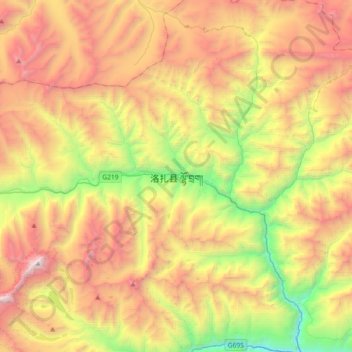
Name: Lhodrak topographic map, elevation, terrain.
Location: Lhodrak, Lhozhag, Lhodrak County, Lhoka, Tibet, China (28.22931 90.69878 28.54931 91.01878)
Average elevation: 15,712 ft
Minimum elevation: 10,928 ft
Maximum elevation: 21,168 ft
Thank you for supporting this site ❤️
Make a donation
Make a donation
Gear up for your next adventure:
As an Amazon Associate, this site earns from qualifying purchases at no extra cost to you.