
Goat Lake topographic map
Interactive map
Click on the map to display elevation.
About this map
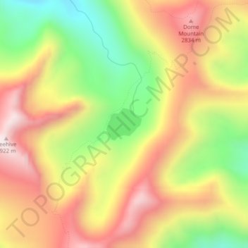
Name: Goat Lake topographic map, elevation, terrain.
Location: Goat Lake, Lemhi County, Idaho, United States (45.22082 -114.53543 45.22433 -114.52994)
Average elevation: 8,497 ft
Minimum elevation: 7,306 ft
Maximum elevation: 9,564 ft
Other topographic maps
Click on a map to view its topography, its elevation and its terrain.
Middle Fork Salmon River
United States > Idaho > Lemhi County
Middle Fork Salmon River, Lemhi County, Idaho, United States
Average elevation: 6,864 ft
Salmon
United States > Idaho > Lemhi County
Salmon, Lemhi County, Idaho, 83467, United States
Average elevation: 4,091 ft