Geolocate

Idaho topographic maps

Click on a map to view its topography, its elevation and its terrain.
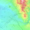
Boise

United States > Idaho > Ada County

Boise (locally /ˈbɔɪsi/ BOY-see) is the capital and most populous city of the U.S. state of Idaho and is the county seat of Ada County. As of the 2020 census, there were 235,684 people residing in the city. On the Boise River in southwestern Idaho, it is 41 miles (66 km) east of the Oregon border and 110…

Average elevation: 3,412 ft
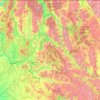
Idaho Panhandle National Forests

United States > Idaho

Elevations on the IPNF range from 2,100 to 7,600 feet with as much as 80 inches of precipitation at high elevations. The IPNF is characterized by several mountain ranges including the Selkirk Mountains, Cabinet Mountains, Purcell Mountains, Coeur d'Alene Mountains, and Bitterroot Range, interspersed with large…

Average elevation: 3,681 ft

Ririe

United States > Idaho > Jefferson County

Average elevation: 4,977 ft

White Bird

United States > Idaho > Idaho County > White Bird

Average elevation: 2,018 ft

Sand Mountain

United States > Idaho

Average elevation: 5,059 ft

Lookout Point

United States > Idaho

Average elevation: 7,874 ft

Mount Regan

United States > Idaho

Average elevation: 8,533 ft

Spring

United States > Idaho

Average elevation: 4,938 ft

Cervidae Peak

United States > Idaho

Average elevation: 3,924 ft

Middle Fork Payette River

United States > Idaho

Average elevation: 5,456 ft

Elk River

United States > Idaho > Clearwater County

Elk River is located at 46°46′58″N 116°10′48″W / 46.78278°N 116.18000°W / 46.78278; -116.18000 (46.782796, -116.180049), at an elevation of 2,854 feet (870 m) above sea level.

Average elevation: 2,976 ft

Salmon-Challis National Forest

United States > Idaho

Average elevation: 6,985 ft

Boise National Forest

United States > Idaho

Average elevation: 5,735 ft

Soldier Lakes

United States > Idaho

Average elevation: 8,159 ft

Hayden

United States > Idaho > Kootenai County

Average elevation: 2,352 ft

Swan Falls

United States > Idaho > Ada County

Average elevation: 2,762 ft

Rupert

United States > Idaho > Minidoka County > Rupert > Rupert

Rupert is located at an elevation of 4,157 feet (1,267 m) above sea level. It is part of the agricultural region of the Snake River Plain known as Magic Valley, and is a few miles north of the Snake River. Interstate 84 passes a few miles to the south, and before its construction, U.S. Route 30 passed through…

Average elevation: 4,157 ft

Nampa

United States > Idaho > Canyon County > Nampa

Average elevation: 2,569 ft

Caldwell

United States > Idaho > Caldwell

Average elevation: 2,392 ft

Meridian

United States > Idaho > Meridian

Average elevation: 2,736 ft

Fernwood

United States > Idaho > Benewah County

Average elevation: 2,894 ft

Rogerson

United States > Idaho > Twin Falls County

Average elevation: 4,915 ft

McDonalds

United States > Idaho > Shoshone County > McDonalds

Average elevation: 5,551 ft

Lowman

United States > Idaho > Boise County

Average elevation: 4,469 ft

De Smet

United States > Idaho > Benewah County

U.S. Route 95 passes nearby and the community is located about a mile (1.6 km) south of Tensed, which was originally also to be titled Desmet before the name was ordered to be reversed and was subsequently misspelled by the post office. Latah Creek flows between the two communities. De Smet has a post office…

Average elevation: 2,605 ft
Careywood

United States > Idaho > Bonner County

Average elevation: 2,428 ft

Lane

United States > Idaho > Kootenai County

Average elevation: 2,408 ft

Burley

United States > Idaho > Cassia County > Burley

Average elevation: 4,170 ft

Atlanta

United States > Idaho > Elmore County

Average elevation: 5,971 ft

Cedarhill

United States > Idaho > Oneida County

Average elevation: 5,417 ft

Cedar Creek

United States > Idaho > Bonner County

Average elevation: 2,454 ft

Box Canyon

United States > Idaho > Fremont County

Average elevation: 6,204 ft

Pine

United States > Idaho > Elmore County

Average elevation: 4,797 ft

Emida

United States > Idaho > Emida

Average elevation: 2,989 ft

Harpster

United States > Idaho > Idaho County

Average elevation: 2,192 ft

Fenn

United States > Idaho > Idaho County

Average elevation: 3,281 ft

Squirrel

United States > Idaho > Fremont County

Average elevation: 5,614 ft

Sandpoint

United States > Idaho > Bonner County > Sandpoint

Average elevation: 2,254 ft

Ahsahka

United States > Idaho > Clearwater County

Average elevation: 1,385 ft

Helmer

United States > Idaho > Latah County

Average elevation: 2,854 ft

Sawtooth City

United States > Idaho > Blaine County

Average elevation: 7,280 ft

Lucile

United States > Idaho > Idaho County

Average elevation: 2,503 ft

Meadows

United States > Idaho > Adams County

Average elevation: 4,026 ft

Centerville

United States > Idaho > Boise County

Average elevation: 4,318 ft

Ola

United States > Idaho > Gem County

Average elevation: 3,094 ft

Benewah

United States > Idaho > Benewah County

Average elevation: 3,035 ft

Mountain Home

United States > Idaho > Elmore County > Mountain Home

Mountain Home is located at 43°8′13″N 115°41′40″W / 43.13694°N 115.69444°W / 43.13694; -115.69444 (43.136812, -115.694474), at an elevation of 3,146 feet (959 m) above sea level.

Average elevation: 3,192 ft

Pingree

United States > Idaho > Bingham County

Average elevation: 4,455 ft

Orofino

United States > Idaho > Clearwater County > Orofino > Orofino

The city has a climate typical of low-elevation areas in Idaho and eastern Washington. Orofino has a dry-summer continental climate (Köppen Dsb). Due to the warm summers, it nearly qualifies as a continental Mediterranean climate (Dsa). Idaho’s all-time highest temperature of 118 °F or 47.8 °C was…

Average elevation: 2,057 ft

Pocono

United States > Idaho > Shoshone County

Average elevation: 2,936 ft

Burgdorf

United States > Idaho > Idaho County

Average elevation: 6,342 ft

Jackson

United States > Idaho > Cassia County

Average elevation: 4,163 ft

Florence

United States > Idaho > Idaho County

Average elevation: 6,089 ft

Smiths Ferry

United States > Idaho > Valley County

Average elevation: 5,003 ft

Greencreek

United States > Idaho > Idaho County

Average elevation: 3,317 ft

Golden

United States > Idaho > Idaho County

Average elevation: 4,252 ft

Pollock

United States > Idaho > Idaho County

Average elevation: 2,995 ft

Orogrande

United States > Idaho > Idaho County

Average elevation: 5,085 ft

Garfield

United States > Idaho > Jefferson County

Average elevation: 4,820 ft

Malad

United States > Idaho > Oneida County

According to the United States Census Bureau, the city has a total area of 1.66 square miles (4.30 km2), all of it land. It lies on the eastern edge of Malad Valley at 4,540 feet (1384 m) in elevation.

Average elevation: 4,813 ft

Island Park

United States > Idaho > Fremont County

Island Park is located at 44°29′59″N 111°20′19″W / 44.49972°N 111.33861°W / 44.49972; -111.33861 (44.4996, −111.3387), at an elevation of 6,293 feet (1,918 m) above sea level, making it the highest city in Idaho.

Average elevation: 6,437 ft

Fort Hall

United States > Idaho > Bingham County

Average elevation: 4,449 ft

Hoyt

United States > Idaho > Shoshone County

Average elevation: 3,219 ft

Cardiff

United States > Idaho > Clearwater County

Average elevation: 3,606 ft

Bern

United States > Idaho > Bear Lake County

Average elevation: 6,096 ft

Prairie

United States > Idaho > Elmore County

Average elevation: 4,875 ft

Bayview

United States > Idaho > Kootenai County

Bayview is an unincorporated community in the northwest United States, located in Kootenai County, Idaho, north of Coeur d'Alene. On the southwest shore of Lake Pend Oreille, Bayview is seven miles (11 km) east-northeast of Athol. The community is served by State Highway 54 and a post office with ZIP code…

Average elevation: 2,405 ft

Clearwater

United States > Idaho > Idaho County

Average elevation: 2,592 ft

Warren

United States > Idaho > Idaho County

Average elevation: 6,253 ft

Silver Sands Beach

United States > Idaho > Kootenai County

Average elevation: 2,513 ft

Jefferson Mount

United States > Idaho > Fremont County

Average elevation: 9,078 ft

Kimama Butte

United States > Idaho > Minidoka County

Average elevation: 4,760 ft

Sinker Butte

United States > Idaho > Owyhee County

Average elevation: 2,927 ft

Sugar Bowl

United States > Idaho > Elmore County

Average elevation: 2,621 ft

Bald Mountain

United States > Idaho > Blaine County

Average elevation: 8,130 ft

Black Mountain

United States > Idaho > Clearwater County

Average elevation: 5,866 ft

Canyon Peak

United States > Idaho > Shoshone County

Average elevation: 3,947 ft

Custer Peak

United States > Idaho > Shoshone County

Average elevation: 5,223 ft

Devils Pulpit

United States > Idaho > Shoshone County

Average elevation: 3,661 ft

Elkhorn Peak

United States > Idaho > Bannock County

Average elevation: 7,986 ft

Hawley Mountain

United States > Idaho > Boise County

Average elevation: 6,637 ft

He Devil

United States > Idaho > Idaho County

Average elevation: 8,169 ft

Lookout Butte

United States > Idaho > Idaho County

Average elevation: 5,151 ft

North Raker

United States > Idaho > Boise County

Average elevation: 8,698 ft

Palisades Peak

United States > Idaho > Bonneville County

Average elevation: 8,497 ft

Sawtell Peak

United States > Idaho > Fremont County

Average elevation: 8,730 ft

Southwest Butte

United States > Idaho > Idaho County

Average elevation: 6,896 ft

Cherry Hill

United States > Idaho > Kootenai County > Coeur d'Alene

Average elevation: 2,323 ft

Malad Gorge State Park

United States > Idaho > Gooding County

Average elevation: 3,143 ft

Miller Water Table

United States > Idaho > Owyhee County

Average elevation: 3,740 ft

Pine Summit

United States > Idaho > Custer County

Average elevation: 7,595 ft

Rocky Butte

United States > Idaho > Blaine County

Average elevation: 5,666 ft

Roman Nose

United States > Idaho > Boundary County

Average elevation: 6,063 ft

Oden Bay

United States > Idaho > Bonner County

Average elevation: 2,054 ft

Thousand Springs

United States > Idaho > Custer County

Average elevation: 6,306 ft

Mesa Falls

United States > Idaho > Fremont County

Average elevation: 5,906 ft

Idaho Falls

United States > Idaho > Bonneville County

Average elevation: 4,961 ft

Fernan Saddle

United States > Idaho > Kootenai County

Average elevation: 3,940 ft

Robie Creek

United States > Idaho > Boise County

Average elevation: 3,658 ft

Stanley Lake

United States > Idaho > Custer County

The lake is approximately seven miles (11 km) west of Stanley, readily accessed via a three-mile (5 km) spur road from State Highway 21. The surface elevation of the lake is 6,513 feet (1,985 m) above sea level.

Average elevation: 6,808 ft

About this place

 •  •  •  •  •  •  •  •  •  •  •  •  •  •  •  •  •  •  •  •  •  •  •  •  •  •  •  •  •  •  •  •  •  •  •  •  •  •  •  •  •  •  •  •  •

Gear up for your next adventure:

🏥Hiking First Aid Kits - Comprehensive medical kits for remote trail injuries
🏫Relief Map Kits - Hands-on tools for teaching landforms and elevation
🧤Tactile Hiking Gloves - Keep hands warm while operating GPS and smartphone screens
🔥Fast-Boil Camping Stoves - Efficient cooking systems for quick trail meals
🛠️Backpacking Tool Kit - Essential toolkit for outdoor repairs

As an Amazon Associate, this site earns from qualifying purchases at no extra cost to you.