
Make a donation
Gear up for your next adventure:
As an Amazon Associate, this site earns from qualifying purchases at no extra cost to you.
Vallejo topographic map
Click on the map to display elevation.
Make a donation
Gear up for your next adventure:
As an Amazon Associate, this site earns from qualifying purchases at no extra cost to you.
Vallejo
Vallejo es una localidad del municipio de Camaleño (Cantabria, España). En el año 2008 tenía 6 habitantes (INE). La localidad está ubicada a 615 metros de altitud sobre el nivel del mar, y a 6 kilómetros de la capital municipal, Camaleño.
Make a donation
Gear up for your next adventure:
As an Amazon Associate, this site earns from qualifying purchases at no extra cost to you.
About this map
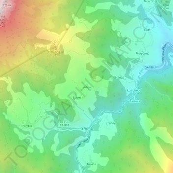
Name: Vallejo topographic map, elevation, terrain.
Location: Vallejo, Camaleño, Cantabria, 39587, España (43.11853 -4.74787 43.15853 -4.70787)
Average elevation: 2,999 ft
Minimum elevation: 1,450 ft
Maximum elevation: 6,201 ft
Make a donation
Gear up for your next adventure:
As an Amazon Associate, this site earns from qualifying purchases at no extra cost to you.