
Thank you for supporting this site ❤️
Make a donation
Make a donation
Gear up for your next adventure:
As an Amazon Associate, this site earns from qualifying purchases at no extra cost to you.
Yura topographic map
Click on the map to display elevation.
Thank you for supporting this site ❤️
Make a donation
Make a donation
Gear up for your next adventure:
As an Amazon Associate, this site earns from qualifying purchases at no extra cost to you.
About this map
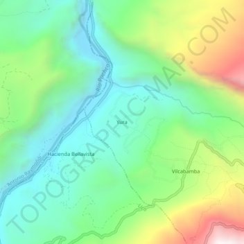
Name: Yura topographic map, elevation, terrain.
Location: Yura, Paucas, Huari, Áncash, Perú (-9.15790 -76.96024 -9.11790 -76.92024)
Average elevation: 8,386 ft
Minimum elevation: 7,054 ft
Maximum elevation: 11,296 ft
Thank you for supporting this site ❤️
Make a donation
Make a donation
Gear up for your next adventure:
As an Amazon Associate, this site earns from qualifying purchases at no extra cost to you.