
Thank you for supporting this site ❤️
Make a donation
Make a donation
Gear up for your next adventure:
As an Amazon Associate, this site earns from qualifying purchases at no extra cost to you.
Tortosendo topographic map
Click on the map to display elevation.
Thank you for supporting this site ❤️
Make a donation
Make a donation
Gear up for your next adventure:
As an Amazon Associate, this site earns from qualifying purchases at no extra cost to you.
About this map
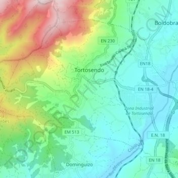
Name: Tortosendo topographic map, elevation, terrain.
Location: Tortosendo, Covilhã, Castelo Branco, Portugal (40.21240 -7.55974 40.25514 -7.48823)
Average elevation: 1,850 ft
Minimum elevation: 1,296 ft
Maximum elevation: 3,301 ft
Thank you for supporting this site ❤️
Make a donation
Make a donation
Gear up for your next adventure:
As an Amazon Associate, this site earns from qualifying purchases at no extra cost to you.