
Make a donation
Gear up for your next adventure:
As an Amazon Associate, this site earns from qualifying purchases at no extra cost to you.
Arizona City topographic map
Click on the map to display elevation.
Make a donation
Gear up for your next adventure:
As an Amazon Associate, this site earns from qualifying purchases at no extra cost to you.
Arizona City
Arizona City itself is mostly flat, lying in the Santa Cruz Valley in the center of three low mountain ranges; the Sawtooth Mountains to the south, the Picacho Mountains to the east, and the Casa Grande Mountains to the north. Picacho Peak, a prominent peak with a summit elevation of 3,374 feet (1,028 m), is located approximately 20 miles (32 km) to the southeast adjacent to Interstate 10. Directly to the west of the CDP is the expansive Tohono O'odham Indian Reservation, which stretches 80 miles (130 km) south to the international border with Mexico.
Make a donation
Gear up for your next adventure:
As an Amazon Associate, this site earns from qualifying purchases at no extra cost to you.
About this map
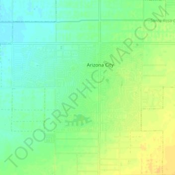
Name: Arizona City topographic map, elevation, terrain.
Location: Arizona City, Pinal County, Arizona, United States (32.73372 -111.70562 32.76302 -111.63682)
Average elevation: 1,506 ft
Minimum elevation: 1,473 ft
Maximum elevation: 1,549 ft
Pinal County trails, hiking, mountain biking, running and outdoor activities
Make a donation
Gear up for your next adventure:
As an Amazon Associate, this site earns from qualifying purchases at no extra cost to you.