Geolocate

Wau-ri topographic map

Click on the map to display elevation.

About this map

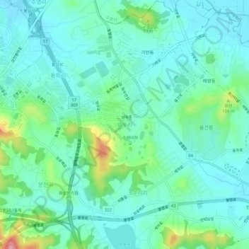
Name: Wau-ri topographic map, elevation, terrain.

Location: Wau-ri, Hwaseong-si, 18323, South Korea (37.19258 126.95467 37.23258 126.99467)

Average elevation: 157 ft

Minimum elevation: 52 ft

Maximum elevation: 531 ft

Gear up for your next adventure:

🛠️Outdoor Gear Repair Kit - Essential tools to fix gear on the trail
🔭Stargazing Telescopes - Perfect for camping in low-light pollution areas shown on maps
🥾Women's Hiking Boots - Top-rated trail boots with ankle support and superior grip
🪶Survival Guide Book - Expert advice for emergency preparedness
📖Nature Tracking Books - Learn to track wildlife and terrain

As an Amazon Associate, this site earns from qualifying purchases at no extra cost to you.