
Thank you for supporting this site ❤️
Make a donation
Make a donation
Gear up for your next adventure:
As an Amazon Associate, this site earns from qualifying purchases at no extra cost to you.
Kambalipura topographic map
Click on the map to display elevation.
Thank you for supporting this site ❤️
Make a donation
Make a donation
Gear up for your next adventure:
As an Amazon Associate, this site earns from qualifying purchases at no extra cost to you.
About this map
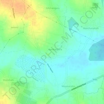
Name: Kambalipura topographic map, elevation, terrain.
Location: Kambalipura, Anekal, Bengaluru Urban, Karnataka, India (12.75636 77.73471 12.76379 77.74850)
Average elevation: 2,907 ft
Minimum elevation: 2,861 ft
Maximum elevation: 2,976 ft
Thank you for supporting this site ❤️
Make a donation
Make a donation
Gear up for your next adventure:
As an Amazon Associate, this site earns from qualifying purchases at no extra cost to you.