
Thank you for supporting this site ❤️
Make a donation
Make a donation
Gear up for your next adventure:
As an Amazon Associate, this site earns from qualifying purchases at no extra cost to you.
Pennisi topographic map
Click on the map to display elevation.
Thank you for supporting this site ❤️
Make a donation
Make a donation
Gear up for your next adventure:
As an Amazon Associate, this site earns from qualifying purchases at no extra cost to you.
About this map
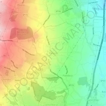
Name: Pennisi topographic map, elevation, terrain.
Location: Pennisi, Acireale, Catania, Sicilia, 95024, Italia (37.62657 15.10560 37.66657 15.14560)
Average elevation: 1,178 ft
Minimum elevation: 725 ft
Maximum elevation: 1,759 ft
Thank you for supporting this site ❤️
Make a donation
Make a donation
Gear up for your next adventure:
As an Amazon Associate, this site earns from qualifying purchases at no extra cost to you.