
Town of Jefferson topographic map
Interactive map
Click on the map to display elevation.
About this map
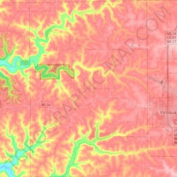
Name: Town of Jefferson topographic map, elevation, terrain.
Location: Town of Jefferson, Vernon County, Wisconsin, United States (43.50932 -91.02954 43.63920 -90.90937)
Average elevation: 1,152 ft
Minimum elevation: 682 ft
Maximum elevation: 1,368 ft
Vernon County trails, hiking, mountain biking, running and outdoor activities
Other topographic maps
Click on a map to view its topography, its elevation and its terrain.