
Thank you for supporting this site ❤️
Make a donation
Make a donation
Gear up for your next adventure:
As an Amazon Associate, this site earns from qualifying purchases at no extra cost to you.
Piediripa topographic map
Click on the map to display elevation.
Thank you for supporting this site ❤️
Make a donation
Make a donation
Gear up for your next adventure:
As an Amazon Associate, this site earns from qualifying purchases at no extra cost to you.
About this map
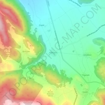
Name: Piediripa topographic map, elevation, terrain.
Location: Piediripa, Norcia, Perugia, Umbria, 06046, Italia (42.72148 13.08980 42.76148 13.12980)
Average elevation: 2,769 ft
Minimum elevation: 2,185 ft
Maximum elevation: 3,796 ft
Thank you for supporting this site ❤️
Make a donation
Make a donation
Gear up for your next adventure:
As an Amazon Associate, this site earns from qualifying purchases at no extra cost to you.