
Thank you for supporting this site ❤️
Make a donation
Make a donation
Gear up for your next adventure:
As an Amazon Associate, this site earns from qualifying purchases at no extra cost to you.
Uchupata topographic map
Click on the map to display elevation.
Thank you for supporting this site ❤️
Make a donation
Make a donation
Gear up for your next adventure:
As an Amazon Associate, this site earns from qualifying purchases at no extra cost to you.
About this map
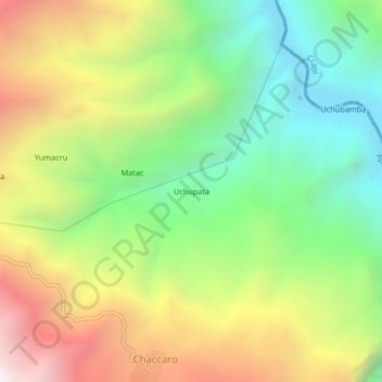
Name: Uchupata topographic map, elevation, terrain.
Location: Uchupata, Tambobamba, Cotabambas, Apurímac, Perú (-13.85111 -72.15198 -13.81111 -72.11198)
Average elevation: 9,987 ft
Minimum elevation: 7,585 ft
Maximum elevation: 13,291 ft
Thank you for supporting this site ❤️
Make a donation
Make a donation
Gear up for your next adventure:
As an Amazon Associate, this site earns from qualifying purchases at no extra cost to you.