
Thank you for supporting this site ❤️
Make a donation
Make a donation
Gear up for your next adventure:
As an Amazon Associate, this site earns from qualifying purchases at no extra cost to you.
Mondrago topographic map
Click on the map to display elevation.
Thank you for supporting this site ❤️
Make a donation
Make a donation
Gear up for your next adventure:
As an Amazon Associate, this site earns from qualifying purchases at no extra cost to you.
About this map
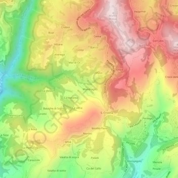
Name: Mondrago topographic map, elevation, terrain.
Location: Mondrago, Marano di Valpolicella, Verona, Veneto, 37020, Italy (45.56651 10.91531 45.60651 10.95531)
Average elevation: 2,067 ft
Minimum elevation: 984 ft
Maximum elevation: 3,035 ft
Thank you for supporting this site ❤️
Make a donation
Make a donation
Gear up for your next adventure:
As an Amazon Associate, this site earns from qualifying purchases at no extra cost to you.