Geolocate

Bingag topographic map

Click on the map to display elevation.

About this map

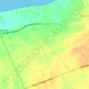
Name: Bingag topographic map, elevation, terrain.

Location: Bingag, Dauis, Bohol, Central Visayas, 6339, Philippines (9.59867 123.78815 9.62859 123.81803)

Average elevation: 62 ft

Minimum elevation: 0 ft

Maximum elevation: 108 ft

Other topographic maps

Click on a map to view its topography, its elevation and its terrain.

San Agustin

Philippines > Bohol > Dauis > Bingag

Average elevation: 33 ft

Gear up for your next adventure:

🩹Survival Bandages - High‑quality bandages for emergencies
Backpacking Tents - Weight-optimized shelters for multi-day topographic surveys
😴Insulated Sleeping Pads - Compact and warm pads for high-elevation camping
🧤Tactile Hiking Gloves - Keep hands warm while operating GPS and smartphone screens
🎒Outdoor Daypacks - Lightweight backpacks designed for carrying maps and essential gear

As an Amazon Associate, this site earns from qualifying purchases at no extra cost to you.