Geolocate

Iskar topographic map

Click on the map to display elevation.

About this map

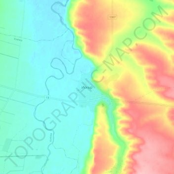
Name: Iskar topographic map, elevation, terrain.

Location: Iskar, Pleven, Bulgaria (43.41976 24.21576 43.49976 24.29576)

Average elevation: 322 ft

Minimum elevation: 164 ft

Maximum elevation: 594 ft

Gear up for your next adventure:

🦶Carbon Trekking Poles - Reduce knee impact on steep descents with ultra-light poles
🦶Hiking Gaiters - Keep debris and water out of your boots
📚Navigation Handbooks - Master the art of reading topographic maps and using a compass
🎁Geography Themed Gifts - Unique gift ideas for map lovers and geography enthusiasts
🧭Pro Hiking Compasses - High-accuracy liquid-filled compasses for topographic orientation

As an Amazon Associate, this site earns from qualifying purchases at no extra cost to you.