
Urús topographic map
Interactive map
Click on the map to display elevation.
About this map
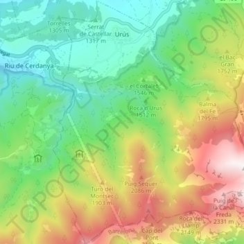
Name: Urús topographic map, elevation, terrain.
Location: Urús, Cerdanya, Gerona, Catalonië, 17538, Spanje (42.30641 1.83316 42.35933 1.89312)
Average elevation: 5,302 ft
Minimum elevation: 3,694 ft
Maximum elevation: 8,015 ft
Other topographic maps
Click on a map to view its topography, its elevation and its terrain.