
Meranges topographic map
Interactive map
Click on the map to display elevation.
About this map
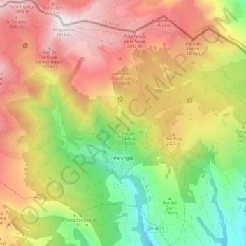
Name: Meranges topographic map, elevation, terrain.
Location: Meranges, Cerdanya, Gerona, Catalonië, Spanje (42.41862 1.72427 42.49539 1.81339)
Average elevation: 6,781 ft
Minimum elevation: 4,091 ft
Maximum elevation: 9,537 ft
Other topographic maps
Click on a map to view its topography, its elevation and its terrain.