Geolocate

Bausone topographic map

Click on the map to display elevation.

About this map

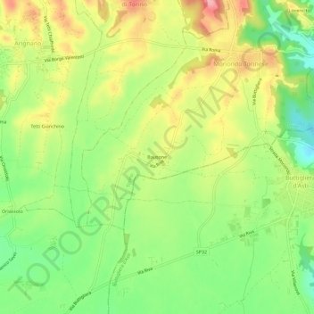
Name: Bausone topographic map, elevation, terrain.

Location: Bausone, Moriondo Torinese, Torino, Piemonte, 14024, Italia (45.00574 7.90491 45.04574 7.94491)

Average elevation: 955 ft

Minimum elevation: 764 ft

Maximum elevation: 1,171 ft

Gear up for your next adventure:

💧Water Filtration Bottles - Safely drink from streams and lakes while exploring
Backpacking Tent - Lightweight and durable tent for multi‑day hikes
🔊Portable Camp Speaker - Music and alerts at camp
🪶Wildlife Field Guides - Learn animal tracking and species ID
🧥Waterproof Jacket for Hiking - Breathable and rugged rain jacket for outdoor excursions

As an Amazon Associate, this site earns from qualifying purchases at no extra cost to you.