
Thank you for supporting this site ❤️
Make a donation
Make a donation
Gear up for your next adventure:
As an Amazon Associate, this site earns from qualifying purchases at no extra cost to you.
Dhumakot topographic map
Click on the map to display elevation.
Thank you for supporting this site ❤️
Make a donation
Make a donation
Gear up for your next adventure:
As an Amazon Associate, this site earns from qualifying purchases at no extra cost to you.
About this map
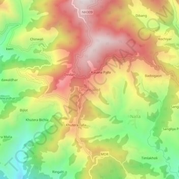
Name: Dhumakot topographic map, elevation, terrain.
Location: Dhumakot, Dhoomakot, Pauri Garhwal, Uttarakhand, 246277, India (29.73015 78.99574 29.77015 79.03574)
Average elevation: 5,266 ft
Minimum elevation: 3,717 ft
Maximum elevation: 6,739 ft
Thank you for supporting this site ❤️
Make a donation
Make a donation
Gear up for your next adventure:
As an Amazon Associate, this site earns from qualifying purchases at no extra cost to you.