Geolocate

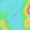
Bayan topographic map

Click on the map to display elevation.

About this map

Name: Bayan topographic map, elevation, terrain.

Location: Bayan, Töv, Mongolia (46.76113 107.19219 47.44184 108.18171)

Average elevation: 4,662 ft

Minimum elevation: 4,088 ft

Maximum elevation: 5,574 ft

Other topographic maps

Click on a map to view its topography, its elevation and its terrain.

Terelj

Mongolia > Töv > Erdene > Ulaanbaatar

Average elevation: 4,852 ft

Terelj

Mongolia > Töv > Erdene > Ulaanbaatar

Average elevation: 4,852 ft

Khagiin khar Lake

Mongolia > Töv > Erdene

Average elevation: 6,181 ft

Zuunmod

Mongolia > Töv > Zuunmod

Average elevation: 5,171 ft

Sergelen

Mongolia > Töv > Sergelen

Average elevation: 4,865 ft

Gear up for your next adventure:

😴Insulated Sleeping Pads - Compact and warm pads for high-elevation camping
🛰️Handheld GPS Units - Professional satellite navigators for precise backcountry mapping
🎒Trekking Poles - Sturdy poles for balance and stability on rough terrain
🔭Telescopic Hiking Pole - Adjustable pole for hiking stability
🌡️Portable Weather Meter - Track weather conditions on the trail

As an Amazon Associate, this site earns from qualifying purchases at no extra cost to you.