Geolocate

Balmorhea topographic map

Click on the map to display elevation.

About this map
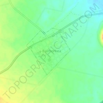
Name: Balmorhea topographic map, elevation, terrain.

Location: Balmorhea, Reeves County, Texas, United States (30.97438 -103.75430 30.99047 -103.73701)

Average elevation: 3,199 ft

Minimum elevation: 3,153 ft

Maximum elevation: 3,251 ft

Reeves County trails, hiking, mountain biking, running and outdoor activities

Other topographic maps

Click on a map to view its topography, its elevation and its terrain.

Saragosa

United States > Texas > Reeves County

Average elevation: 3,005 ft

Orla

United States > Texas > Reeves County

Average elevation: 2,874 ft

Gear up for your next adventure:

🔊Portable Camp Speaker - Music and alerts at camp
🔋Rechargeable Batteries - Power up your outdoor devices
🔭Telescopic Hiking Pole - Adjustable pole for hiking stability
🪶Fire Starter Kit - Reliable fire starter for survival and camping
🧥Men's Rain Shells - Premium waterproof and breathable jackets for mountain weather

As an Amazon Associate, this site earns from qualifying purchases at no extra cost to you.