
Thank you for supporting this site ❤️
Make a donation
Make a donation
Gear up for your next adventure:
As an Amazon Associate, this site earns from qualifying purchases at no extra cost to you.
Cevide topographic map
Click on the map to display elevation.
Thank you for supporting this site ❤️
Make a donation
Make a donation
Gear up for your next adventure:
As an Amazon Associate, this site earns from qualifying purchases at no extra cost to you.
About this map
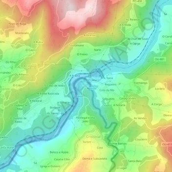
Name: Cevide topographic map, elevation, terrain.
Location: Cevide, Cristoval, Melgaço, Viana do Castelo, Portugal (42.13234 -8.21765 42.17234 -8.17765)
Average elevation: 748 ft
Minimum elevation: 125 ft
Maximum elevation: 1,745 ft
Thank you for supporting this site ❤️
Make a donation
Make a donation
Gear up for your next adventure:
As an Amazon Associate, this site earns from qualifying purchases at no extra cost to you.