Geolocate

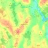
Springmount topographic map

Click on the map to display elevation.

About this map

Name: Springmount topographic map, elevation, terrain.

Location: Springmount, Killann ED, New Ross Municipal District, The Municipal District of New Ross, County Wexford, Leinster, Ireland (52.53346 -6.78915 52.54621 -6.75017)

Average elevation: 594 ft

Minimum elevation: 276 ft

Maximum elevation: 1,250 ft

Other topographic maps

Click on a map to view its topography, its elevation and its terrain.

Gear up for your next adventure:

☀️Outdoor Sunscreen - High protection sunscreen for outdoor activities
🕶️GPS Smartphone Mount - Secure mount for phone navigation
🗺️NatGeo Topo Maps - High-quality waterproof printed topographic maps of US Parks
⛺Backpacking Tent - Lightweight and durable tent for multi‑day hikes
🧺Microfiber Travel Towels - Compact and fast-drying towels for trail use

As an Amazon Associate, this site earns from qualifying purchases at no extra cost to you.