
Sullivan topographic map
Click on the map to display elevation.
About this map
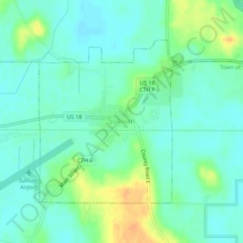
Name: Sullivan topographic map, elevation, terrain.
Location: Sullivan, Jefferson County, Wisconsin, 53178, United States (43.00361 -88.60071 43.02174 -88.58037)
Average elevation: 860 ft
Minimum elevation: 823 ft
Maximum elevation: 935 ft
Jefferson County trails, hiking, mountain biking, running and outdoor activities
Other topographic maps
Click on a map to view its topography, its elevation and its terrain.
Aztalan State Park
United States > Wisconsin > Jefferson County > Town of Aztalan
Average elevation: 837 ft