
Thank you for supporting this site ❤️
Make a donation
Make a donation
Gear up for your next adventure:
As an Amazon Associate, this site earns from qualifying purchases at no extra cost to you.
Blieskastel topographic map
Click on the map to display elevation.
Thank you for supporting this site ❤️
Make a donation
Make a donation
Gear up for your next adventure:
As an Amazon Associate, this site earns from qualifying purchases at no extra cost to you.
About this map
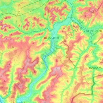
Name: Blieskastel topographic map, elevation, terrain.
Location: Blieskastel, Saarpfalz-Kreis, Saarland, 66440, Germany (49.12958 7.17816 49.29908 7.36896)
Average elevation: 965 ft
Minimum elevation: 659 ft
Maximum elevation: 1,342 ft
Thank you for supporting this site ❤️
Make a donation
Make a donation
Gear up for your next adventure:
As an Amazon Associate, this site earns from qualifying purchases at no extra cost to you.