Geolocate

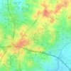
Shoham topographic map

Click on the map to display elevation.

About this map
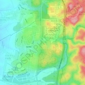
Name: Shoham topographic map, elevation, terrain.

Location: Shoham, Ramla Subdistrict, Center District, Israel (31.98258 34.93170 32.02248 34.96798)

Average elevation: 331 ft

Minimum elevation: 161 ft

Maximum elevation: 643 ft

Other topographic maps

Click on a map to view its topography, its elevation and its terrain.
Kfar Saba

Israel > Center District

Average elevation: 177 ft

Zur Izhak

Israel > Center District

Average elevation: 276 ft

Lod

Israel > Center District

Average elevation: 200 ft

Gear up for your next adventure:

🕶️Glacier Sunglasses - Side shields to protect eyes from high-altitude snow glare
🦺Reflective Outdoor Gear - Safety gear for low‑light conditions
🍳Camping Cook Set - Complete cookware for outdoor meals
🧭GPS Watch Accessories - Bands and chargers for GPS watches
🔊Portable Camp Speaker - Music and alerts at camp

As an Amazon Associate, this site earns from qualifying purchases at no extra cost to you.