Geolocate

Xingning topographic map

Click on the map to display elevation.

About this map

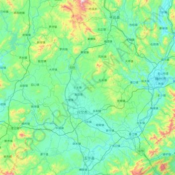
Name: Xingning topographic map, elevation, terrain.

Location: Xingning, Meizhou, Guangdong Province, China (23.85185 115.47896 24.64666 116.03418)

Average elevation: 873 ft

Minimum elevation: 233 ft

Maximum elevation: 4,327 ft

Gear up for your next adventure:

🧭Map Reading Tools - Tools and kits for map navigation
📌Outdoor GPS Map App - Apps and devices for digital topographic navigation
🌎3D Topographic Globes - Raised relief globes for a tactile understanding of geography
📶Vehicle Signal Boosters - Improve reception in rural areas while driving to trailheads
🛰️Handheld GPS Units - Professional satellite navigators for precise backcountry mapping

As an Amazon Associate, this site earns from qualifying purchases at no extra cost to you.