
Make a donation
Gear up for your next adventure:
As an Amazon Associate, this site earns from qualifying purchases at no extra cost to you.
Cleversulzbach topographic map
Click on the map to display elevation.
Make a donation
Gear up for your next adventure:
As an Amazon Associate, this site earns from qualifying purchases at no extra cost to you.
About this map
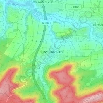
Name: Cleversulzbach topographic map, elevation, terrain.
Average elevation: 738 ft
Minimum elevation: 548 ft
Maximum elevation: 1,132 ft
Make a donation
Gear up for your next adventure:
As an Amazon Associate, this site earns from qualifying purchases at no extra cost to you.
Other topographic maps
Click on a map to view its topography, its elevation and its terrain.
Stein am Kocher
Deutschland > Baden-Württemberg > Landkreis Heilbronn > Neuenstadt am Kocher
Average elevation: 712 ft
Kochertürn
Deutschland > Baden-Württemberg > Landkreis Heilbronn > Neuenstadt am Kocher
Die Gemarkung von Kochertürn erstreckt sich wie eine schmale Spindel über sieben Kilometer weit von den westlichen Ausläufern des Harthäuser Waldes im Nordosten, wo sie eine Höhe von etwa 283 m ü. NHN erreicht, über das Dorf und den Fluss hinweg, an dem ihr mit 156 m ü. NHN niedrigster Punkt liegt, bis…
Average elevation: 689 ft
Cleversulzbach
Deutschland > Baden-Württemberg > Landkreis Heilbronn > Neuenstadt am Kocher
Average elevation: 794 ft