Geolocate

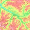
Trois-Rivières topographic map

Click on the map to display elevation.

About this map

Name: Trois-Rivières topographic map, elevation, terrain.

Location: Trois-Rivières, Montdidier, Somme, Hauts-de-France, Metropolitan France, 80500, France (49.68980 2.49591 49.73797 2.58579)

Average elevation: 272 ft

Minimum elevation: 118 ft

Maximum elevation: 394 ft

Other topographic maps

Click on a map to view its topography, its elevation and its terrain.

Petit-Camon

France > Hauts-de-France > Somme > Camon

Average elevation: 240 ft

Amiens

France > Hauts-de-France > Somme > Amiens

Average elevation: 282 ft

Larronville

France > Hauts-de-France > Somme > Rue

Average elevation: 26 ft

Le Quesnoy

France > Hauts-de-France > Somme > Parvillers-le-Quesnoy

Average elevation: 328 ft

Wadicourt

France > Hauts-de-France > Somme > Dompierre-sur-Authie

Average elevation: 217 ft

Gear up for your next adventure:

🧺Microfiber Travel Towels - Compact and fast-drying towels for trail use
🎒Trail Energy Bars - High‑calorie bars for hiking energy
🧢Outdoor Hiking Hat - Sun protection hat for outdoor explorers
🔋Solar Power Banks - Keep your GPS and phone charged in remote wilderness areas
😴Insulated Sleeping Pads - Compact and warm pads for high-elevation camping

As an Amazon Associate, this site earns from qualifying purchases at no extra cost to you.