
Thank you for supporting this site ❤️
Make a donation
Make a donation
Gear up for your next adventure:
As an Amazon Associate, this site earns from qualifying purchases at no extra cost to you.
Darup topographic map
Click on the map to display elevation.
Thank you for supporting this site ❤️
Make a donation
Make a donation
Gear up for your next adventure:
As an Amazon Associate, this site earns from qualifying purchases at no extra cost to you.
About this map
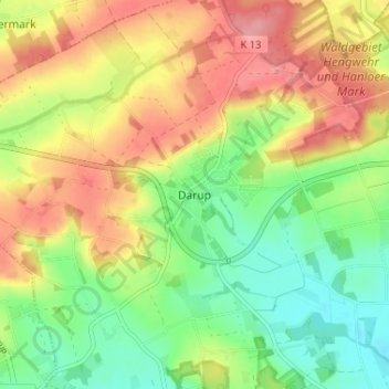
Name: Darup topographic map, elevation, terrain.
Location: Darup, Nottuln, Kreis Coesfeld, Nordrhein-Westfalen, Deutschland (51.90942 7.27681 51.94942 7.31681)
Average elevation: 404 ft
Minimum elevation: 256 ft
Maximum elevation: 568 ft
Thank you for supporting this site ❤️
Make a donation
Make a donation
Gear up for your next adventure:
As an Amazon Associate, this site earns from qualifying purchases at no extra cost to you.