Geolocate

Pinneli topographic map

Click on the map to display elevation.

About this map

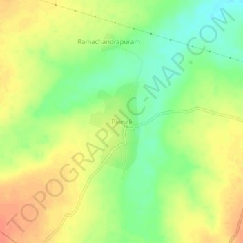
Name: Pinneli topographic map, elevation, terrain.

Location: Pinneli, Machavaram, Palnadu, Andhra Pradesh, 522435, India (16.55014 79.81282 16.59014 79.85282)

Average elevation: 299 ft

Minimum elevation: 220 ft

Maximum elevation: 361 ft

Gear up for your next adventure:

🕶️GPS Smartphone Mount - Secure mount for phone navigation
🔋Rechargeable Batteries - Power up your outdoor devices
💧Water Purification System - Clean water on the trail with reliable purifiers
🪵Folding Camp Saw - Compact saw for wood and campsite work
🪶Trail Camera - Capture wildlife on your hikes

As an Amazon Associate, this site earns from qualifying purchases at no extra cost to you.