Geolocate

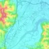
Krnete topographic map

Click on the map to display elevation.

About this map

Name: Krnete topographic map, elevation, terrain.

Location: Krnete, Town of Laktaši, Republika Srpska, Bosnia and Herzegovina (44.93180 17.25011 44.96410 17.29467)

Average elevation: 482 ft

Minimum elevation: 361 ft

Maximum elevation: 735 ft

Other topographic maps

Click on a map to view its topography, its elevation and its terrain.

Gear up for your next adventure:

🪶Thermal Camp Blanket - Extra warmth for cold nights
🧤Hiking Gloves - Protective gloves for rugged trails
📦Dry Bags Set - Waterproof storage for electronics and clothes
📦Gear Storage Bags - Organize and protect outdoor equipment
🔭Telescopic Hiking Pole - Adjustable pole for hiking stability

As an Amazon Associate, this site earns from qualifying purchases at no extra cost to you.