

Selonnet topographic map
Click on the map to display elevation.
About this map

Name: Selonnet topographic map, elevation, terrain.
Average elevation: 4,249 ft
Minimum elevation: 2,766 ft
Maximum elevation: 6,650 ft
Other topographic maps
Click on a map to view its topography, its elevation and its terrain.

Aco de Paret
France > Provence-Alpes-Côte d'Azur > Alpes-de-Haute-Provence > Turriers
Average elevation: 3,642 ft

Les Bonnefoys
France > Provence-Alpes-Côte d'Azur > Alpes-de-Haute-Provence > Les Omergues
Average elevation: 3,304 ft

La Freyssinie
France > Provence-Alpes-Côte d'Azur > Alpes-de-Haute-Provence > Bellaffaire
Average elevation: 3,612 ft

Lachaup
France > Provence-Alpes-Côte d'Azur > Alpes-de-Haute-Provence > Bellaffaire
Average elevation: 3,038 ft
Ondres
France > Provence-Alpes-Côte d'Azur > Alpes-de-Haute-Provence > Thorame-Haute
Average elevation: 4,728 ft

Sommet de Tigne
France > Provence-Alpes-Côte d'Azur > Alpes-de-Haute-Provence > Volonne
Average elevation: 1,916 ft
Saint-Michel
France > Provence-Alpes-Côte d'Azur > Alpes-de-Haute-Provence > Moustiers-Sainte-Marie
Average elevation: 2,398 ft
Molanès
France > Provence-Alpes-Côte d'Azur > Alpes-de-Haute-Provence > Uvernet-Fours
Average elevation: 5,138 ft
Mont d'Or
France > Provence-Alpes-Côte d'Azur > Alpes-de-Haute-Provence > Manosque
Average elevation: 1,293 ft
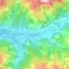
Barcelonnette
France > Provence-Alpes-Côte d'Azur > Alpes-de-Haute-Provence > Barcelonnette > Barcelonnette
Barcelonnette is situated in the wide and fertile Ubaye Valley, of which it is the largest town. It lies at an elevation of 1132 m (3717 ft) on the right bank of the Ubaye River, and is surrounded by mountains which reach peaks of over 3000 m; the tallest of these is the Needle of Chambeyron at 3412 m.…
Average elevation: 4,902 ft
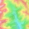
La Foux d'Allos
France > Provence-Alpes-Côte d'Azur > Alpes-de-Haute-Provence > Allos
Average elevation: 6,870 ft
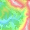
Chavailles
France > Provence-Alpes-Côte d'Azur > Alpes-de-Haute-Provence > Prads-Haute-Bléone
Average elevation: 4,892 ft
Saint-Michel
France > Provence-Alpes-Côte d'Azur > Alpes-de-Haute-Provence > Moustiers-Sainte-Marie
Average elevation: 2,398 ft
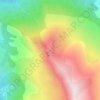
La Croix
France > Provence-Alpes-Côte d'Azur > Alpes-de-Haute-Provence > Jausiers
Average elevation: 6,982 ft
Revest
France > Provence-Alpes-Côte d'Azur > Alpes-de-Haute-Provence > Malijai
Average elevation: 1,719 ft
Le Caravon
France > Provence-Alpes-Côte d'Azur > Alpes-de-Haute-Provence > Oppedette
Average elevation: 1,814 ft